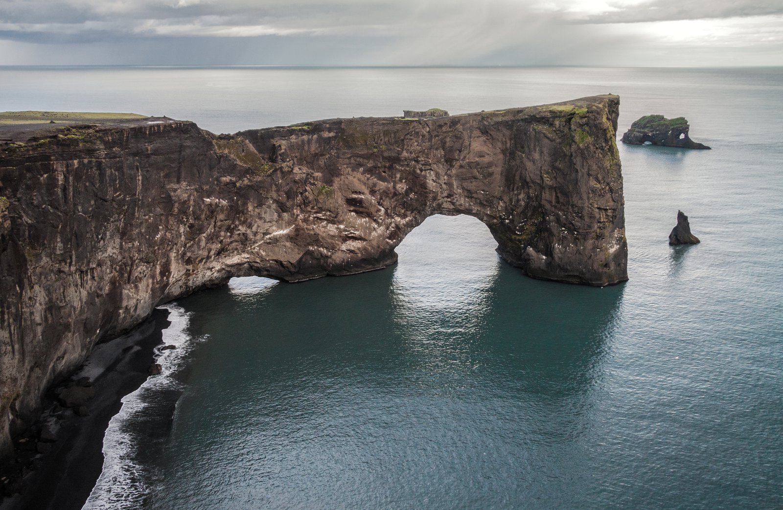
Photo spot in Dyrhólaey
The lighthouse clifftop
The upper level, up a steep track, with the white lighthouse, the arch below and glaciers on the inland horizon.
About The lighthouse clifftop
Get directionsThe upper plateau is reached by a short, steep and rough track that climbs from the junction — a high-clearance or 4×4 car is the sensible choice, and the road closes in bad weather and sometimes during the nesting season. At the top, a squat white lighthouse stands on the highest point of the promontory, with the sea arch directly below on the seaward side and, on a clear day, the Mýrdalsjökull ice cap on the horizon behind.
The lighthouse gives what the rest of the south coast lacks: a built structure to anchor a frame. Shoot it against open sky from below for a graphic silhouette, or use it small in the corner with the couple on the cliff edge — well back from it — for scale. Sunset from up here covers the arch, the beach and the stacks in one sweep.
This is the windiest point of a windy headland; gusts here can knock a person off balance, and the cliff is undercut. Nobody works near the lip, and a veil or a long dress needs a hand and a plan. Check both the road status and the current nesting closure before building a session around this level.
Best time to shoot
Sunset in summer; any clear hour in winter
Tips
Use the lighthouse small in frame with the couple back from the edge — it reads as scale, not subject. Check the road and closure status first.
Recent work in Dyrhólaey
Portfolio shots by photographers covering this area
Photographers who shoot at The lighthouse clifftop
Hand-picked professionals working in Dyrhólaey
Real reviews from Dyrhólaey photoshoots
Marly G.
I have done a few photoshoots with Smári and always have had a great experience. He is a great photographer and has such a good eye for great locations for the kind of photoshoot I had in mind. I am always surprised at how good the photos…
Johann K.
Photographer
Gísli F.
I am a part of a choir in Iceland, and we played a part in a JCS (Jesus Christ Superstar) production at Harpa in Reykjavík, Iceland. I asked my friend Johann Smári to attend the dress rehearsal and feel free to take some photos. The…
Johann K.
Photographer
Other spots in Dyrhólaey
The lower plateau
The easy level, reachable in any car, looking east along the black sand to the Reynisdrangar sea stacks.
The arch from the western bay
The profile view of the door-hole itself, with surf running through the opening and sea stacks beyond.
The puffin cliffs, May to August
Grass-topped cliff edges where puffins nest through the summer — long lens, marked viewpoints and closures to check before you go.
Ready to book?
Our concierge team will hand-pick 2-3 photographers who know The lighthouse clifftop — free of charge.