Lugar fotográfico en Stuðlagil
Abajo en el lecho del río, orilla oeste
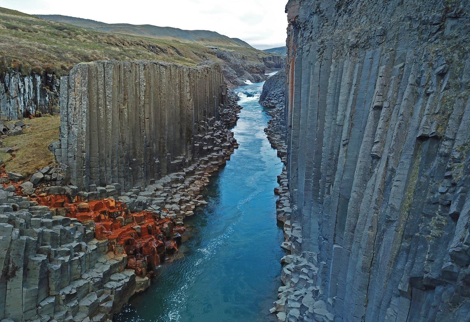
Cinco kilómetros de pista en cada sentido desde Klaustursel, que terminan entre las propias columnas: la vista desde dentro del cañón en lugar de desde arriba.
Sobre Abajo en el lecho del río, orilla oeste
Cómo llegarEl lado oeste es la versión comprometida. Desde la granja de Klaustursel, una pista sigue el río unos cinco kilómetros y, al final, se baja al fondo del cañón, donde las columnas de basalto se alzan por encima de la cabeza a ambos lados y el agua corre justo a los pies. Es la imagen en la que piensa la gente cuando piensa en Stuðlagil, y son muchos menos los que llegan hasta ahí.
Calcule medio día para la ida y la vuelta, calce botas y tómese el tiempo en serio: en la pista no hay ningún refugio. Cuánto fondo de cañón se puede recorrer depende por completo del nivel del río, que sube con la lluvia y el deshielo; en una semana húmeda, las mejores posiciones están sencillamente bajo el agua.
La caminata compensa por sí sola: Stuðlafoss, una cascada sobre un muro de columnas, está junto al sendero un kilómetro antes del cañón y forma una segunda escena natural. Dentro del cañón, la luz lateral baja rastrilla las caras de las columnas por la mañana y al atardecer; al mediodía las paredes se aplanan. Evite las cabezas de columna mojadas y trate los bloques del borde del agua como resbaladizos, porque lo son.
Mejor momento para fotografiar
Luz de la mañana o del atardecer; de junio a septiembre para el agua azul
Consejos
Medio día y botas de verdad. El nivel del río decide cuánto fondo de cañón es transitable: consulte fotos recientes antes de comprometerse.
Otros lugares en Stuðlagil
La plataforma de observación del lado este
Cinco minutos a pie desde el aparcamiento hasta una plataforma que mira en vertical sobre hileras de columnas hexagonales y el río azul que corre entre ellas.
Stuðlafoss
Una cascada que se vierte sobre un muro curvo de columnas de basalto, un kilómetro antes del cañón en el sendero de la orilla oeste, y casi siempre vacía.
¿Listo para reservar?
Nuestro equipo de concierge seleccionará 2-3 fotógrafos que conozcan Abajo en el lecho del río, orilla oeste — gratis.