Foto-Spot in Dyrhólaey
Die Klippe mit dem Leuchtturm
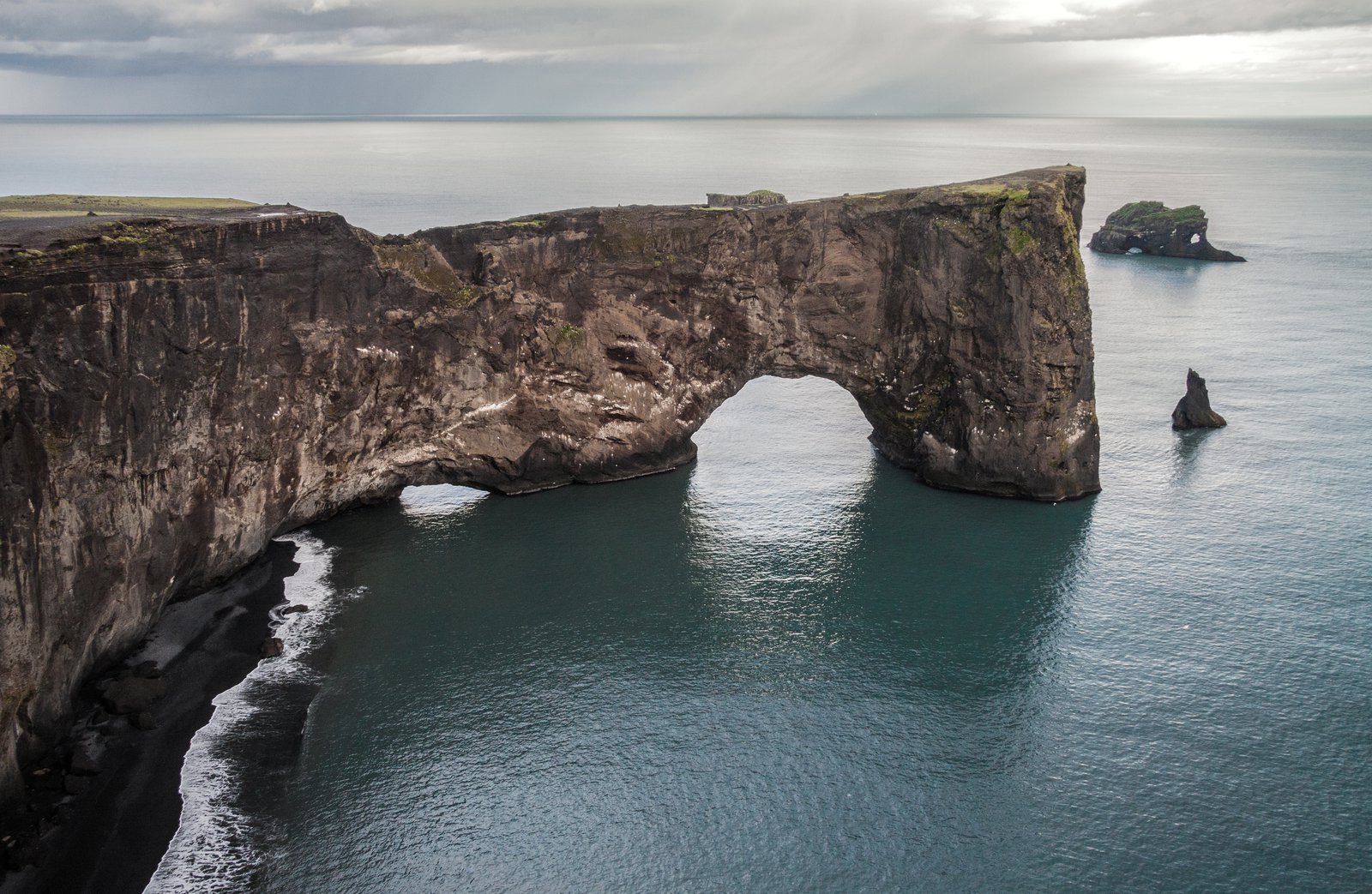
Die obere Ebene, über eine steile Piste erreichbar, mit dem weißen Leuchtturm, dem Felsentor darunter und Gletschern am Landhorizont.
Über Die Klippe mit dem Leuchtturm
Route anzeigenDas obere Plateau erreicht man über eine kurze, steile und grobe Piste, die von der Abzweigung hinaufführt — ein Auto mit Bodenfreiheit oder ein Allrad ist die vernünftige Wahl, und die Straße schließt bei schlechtem Wetter und manchmal während der Brutzeit. Oben steht ein gedrungener weißer Leuchtturm auf dem höchsten Punkt der Landzunge, das Felsentor direkt darunter auf der Seeseite und an einem klaren Tag der Mýrdalsjökull am Horizont dahinter.
Der Leuchtturm liefert, was der übrigen Südküste fehlt: ein Bauwerk, das ein Bild verankert. Setzen Sie ihn von unten gegen den offenen Himmel für eine grafische Silhouette, oder klein in die Ecke, mit dem Paar an der Klippenkante — weit davon zurück — für den Maßstab. Der Sonnenuntergang von hier oben nimmt Felsentor, Strand und Felsnadeln in einem Zug mit.
Das ist der windigste Punkt einer windigen Landzunge; Böen können hier einen Menschen aus dem Gleichgewicht bringen, und die Klippe ist unterhöhlt. Niemand arbeitet nahe der Kante, und ein Schleier oder ein langes Kleid braucht eine Hand und einen Plan. Prüfen Sie sowohl den Straßenzustand als auch die aktuelle Brutzeitsperrung, bevor Sie eine Session um diese Ebene herum bauen.
Beste Zeit zum Fotografieren
Sonnenuntergang im Sommer; jede klare Stunde im Winter
Tipps
Den Leuchtturm klein im Bild lassen, das Paar zurück von der Kante — er liest sich als Maßstab, nicht als Motiv. Zuerst Straßenzustand und Sperrung prüfen.
Aktuelle Arbeiten in Dyrhólaey
Portfolio-Aufnahmen von Fotografen, die diese Gegend abdecken
Fotografen, die hier arbeiten: Die Klippe mit dem Leuchtturm
Handverlesene Profis, die in Dyrhólaey
Echte Bewertungen von Fotoshootings in Dyrhólaey
Marly G.
Ich habe bereits ein paar Fotoshootings mit Smári gemacht und hatte jedes Mal eine tolle Erfahrung. Er ist ein großartiger Fotograf und hat ein wirklich gutes Auge für tolle Locations für die Art von Fotoshooting, die ich mir vorgestellt…
Johann K.
Fotograf
Gísli F.
Ich singe in einem Chor in Island, und wir haben bei einer Produktion von Jesus Christ Superstar in der Harpa in Reykjavík mitgewirkt. Ich habe meinen Freund Johann Smári gebeten, zur Generalprobe zu kommen und gern ein paar Fotos zu…
Johann K.
Fotograf
Weitere Orte in Dyrhólaey
Das untere Plateau
Die einfache Ebene, mit jedem Auto erreichbar, mit Blick nach Osten über den schwarzen Sand bis zu den Felsnadeln der Reynisdrangar.
Das Felsentor von der Westbucht aus
Die Profilansicht des Türlochs selbst, mit der Brandung, die durch die Öffnung läuft, und Felsnadeln dahinter.
Die Papageitaucherklippen, Mai bis August
Grasbewachsene Klippenkanten, in denen den Sommer über Papageitaucher brüten — lange Brennweite, markierte Aussichtspunkte und Sperrungen, die man vorher prüft.
Bereit zur Buchung?
Unser Concierge-Team wählt 2-3 Fotografen für Sie aus, die Die Klippe mit dem Leuchtturm — kostenfrei.